UX CASE STUDY — TRANSIT — 2025
FLYING LAP
YEAR
PLATFORM
DISCIPLINE
TERRITORY
“Take care of the minutes and the hours will take care of themselves”
01 — INTRODUCTION
TRANSFORMING THE COMMUTE
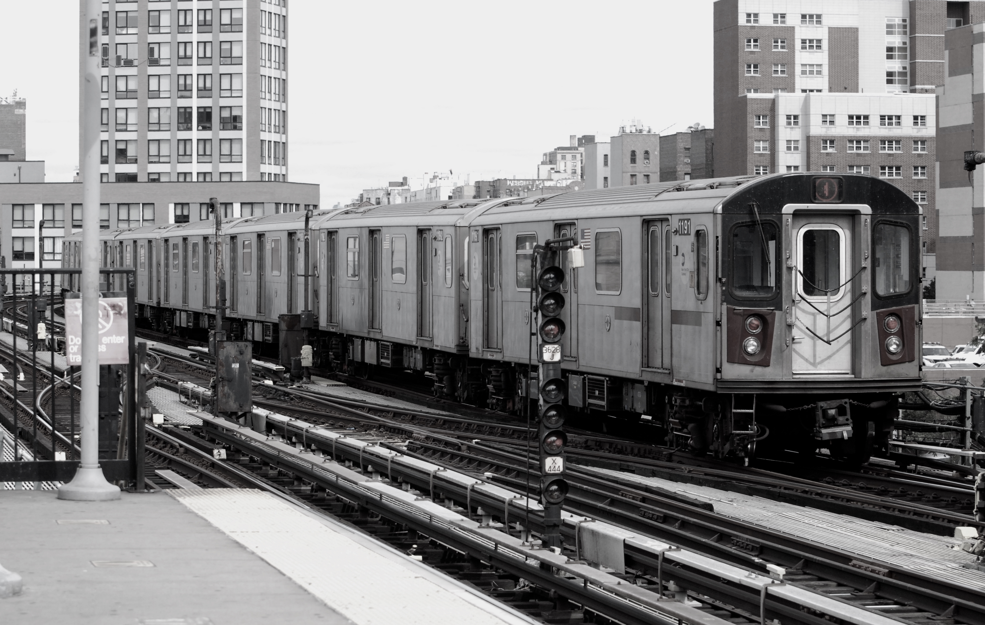
For many commuters, public transit involves more than simply getting from point A to point B. Unfamiliar stops, unexpected changes, complicated transfers, and the pressure of the daily rush can make even a routine journey feel uncertain. Flying Lap is designed to reduce that uncertainty through timely stop alerts and intelligent route suggestions. By helping riders stay oriented and adapt when their journey changes, the app aims to make public transit more predictable, efficient, and reassuring—regardless of the destination. Now the question becomes: How might we make public transit easier to navigate by providing commuters with timely, context-aware notifications and alternative route options, so they can reach their destinations confidently—even when plans change?
02 — DEFINE
MEET THE CLIENTS
Our user-centered design process was grounded in the experiences of two clients with very different commuting needs. One is a frequent commuter who prioritizes speed and efficiency, while the other is an occasional visitor who needs clarity and reassurance. Their experiences helped us identify practical, real-world transit challenges and ensured that our design decisions responded to genuine user needs.

Tardy Tommy — The Platform Runner:
Tommy is a 23-year-old student, photographer, and advertising and branding intern who lives in Jersey City and attends school in New York City. Although he commutes between the two cities every day and knows the train routes well, changing arrival times and service conditions make it difficult for him to determine which option will actually be the fastest. As he explains, “I can take the A or C. Sometimes the R comes first, but the 4 or 5 usually gets me there the fastest.” Tommy is also a night owl who often wakes up with little time to spare, forcing him to rush and make route decisions under pressure. He needs real-time comparisons that can immediately identify the fastest available route and help him use the limited time he has more effectively.
Giddy Gabrielle — The Out-of-Towner:
Gabrielle is a 19-year-old student from Upstate New York who occasionally visits New York City and is interested in fashion and modern art. Because she is unfamiliar with the subway system, limited in-train wayfinding and unclear passenger announcements make it difficult for her to remain oriented, causing her to worry about missing her stop. To make each journey easier to understand, she often avoids transfers and chooses the most direct or familiar route, even when switching to an express train could save time. Gabrielle needs clear stop notifications and simple route guidance that can help her travel confidently while still introducing faster options in a way that does not feel overwhelming.
THE TARGET USER GROUP
Flying Lap is designed for people navigating New York City’s complex and fast-moving public transit system, ranging from daily commuters to occasional visitors. These users include students, young professionals, and travelers who need to reach their destinations on time but may struggle with missed stops, crowded platforms, unclear announcements, unexpected service changes, and the difficulty of identifying the fastest route among multiple options. By providing timely notifications, real-time guidance, and intelligent route recommendations, Flying Lap aims to reduce uncertainty and make traveling through New York City feel smoother, clearer, and more manageable.
03 — Research
Understanding the Competitive Landscape
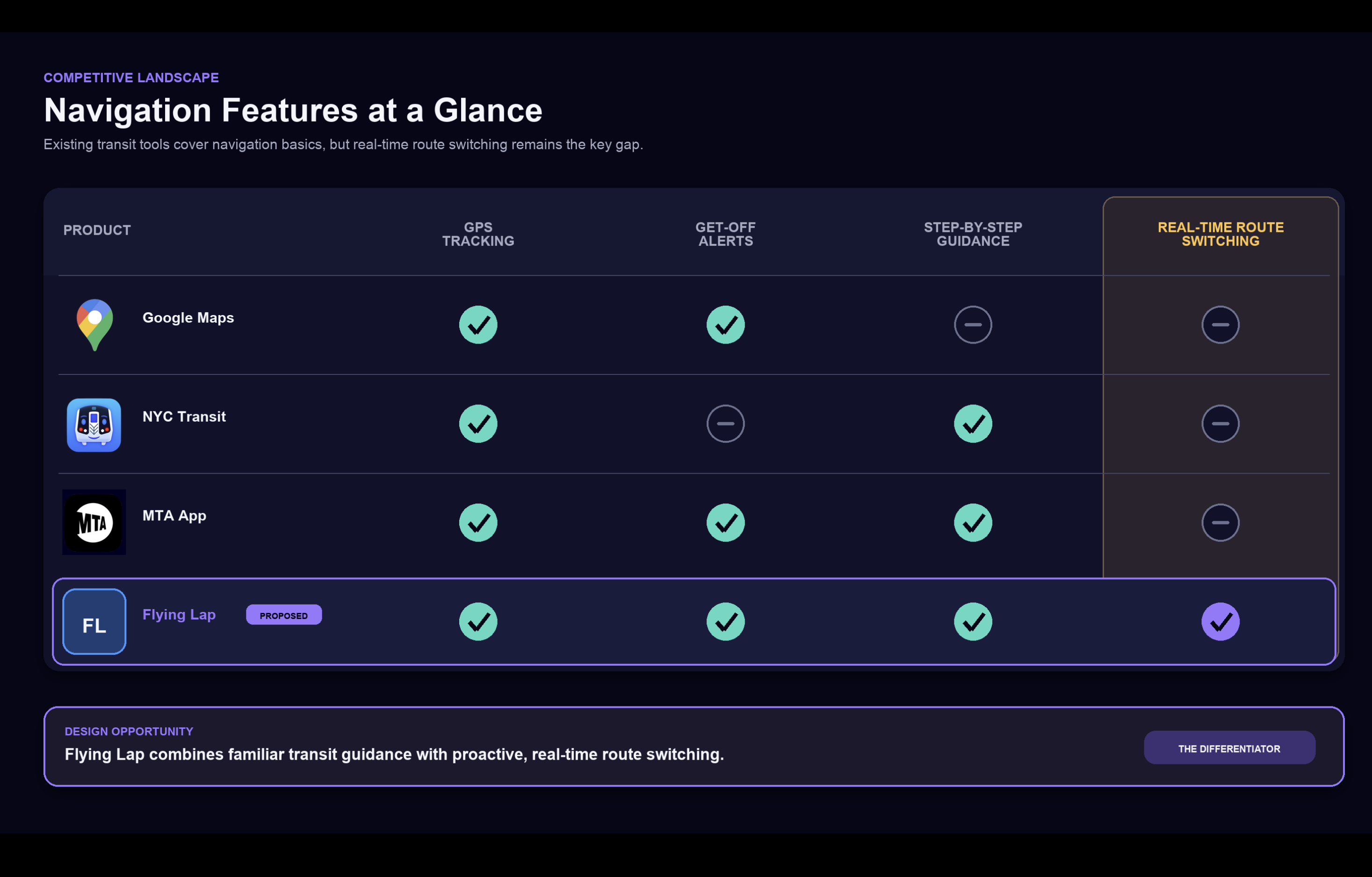
Our competitive review found that products such as Google Maps and existing NYC transit apps already provide useful features, including arrival information, get-off reminders, and basic step-by-step directions. However, these tools do not always break a journey into the small, timely actions needed by riders who are unfamiliar with the transit system, and alternative routes may not be surfaced clearly when conditions change during a trip. This gap revealed an opportunity for Flying Lap to provide more proactive guidance, clearer incremental instructions, and real-time route recommendations that help users respond confidently throughout their journey.
04 — DESIGN
THE FLYING LAP
Flying Lap is an adaptive transit navigation app designed to help New York City commuters travel with greater confidence. By combining clear step-by-step guidance, timely get-off alerts, and real-time route switching, the app supports both riders who need additional direction and experienced commuters searching for a faster alternative. Instead of requiring users to repeatedly compare routes or worry about missing a stop, Flying Lap responds to changing conditions throughout the journey and helps them reach their destination smoothly and efficiently.

1. Route Selection
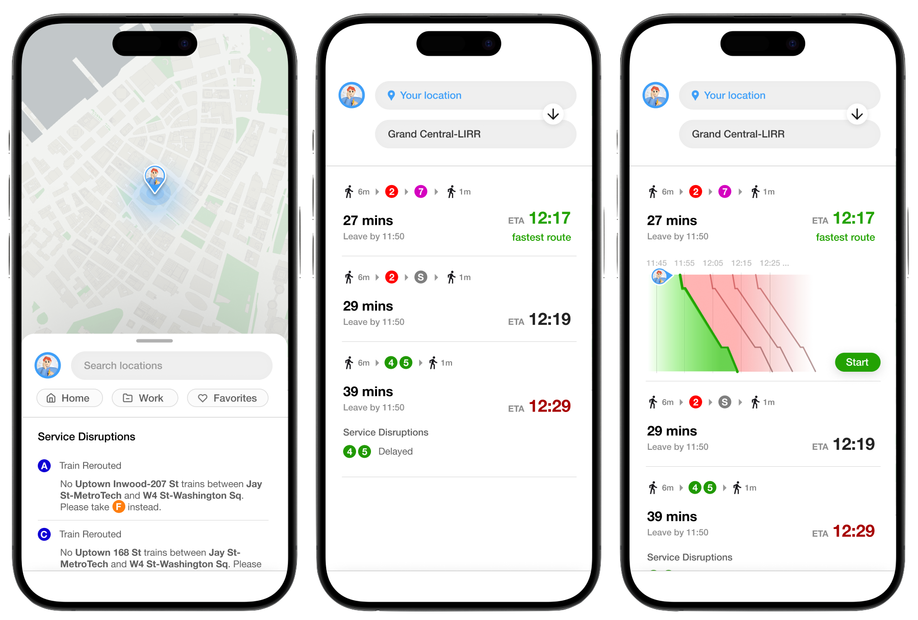
The initial route selection screen presents users with several available ways to reach their destination, allowing them to compare each option before beginning the journey. When a route is selected, its card expands to reveal additional information, including a visual timeline that shows the latest time the user can depart and still arrive on schedule. This interaction keeps the initial interface simple while making more detailed planning information available when it is needed.
2. In-Transit Guidance
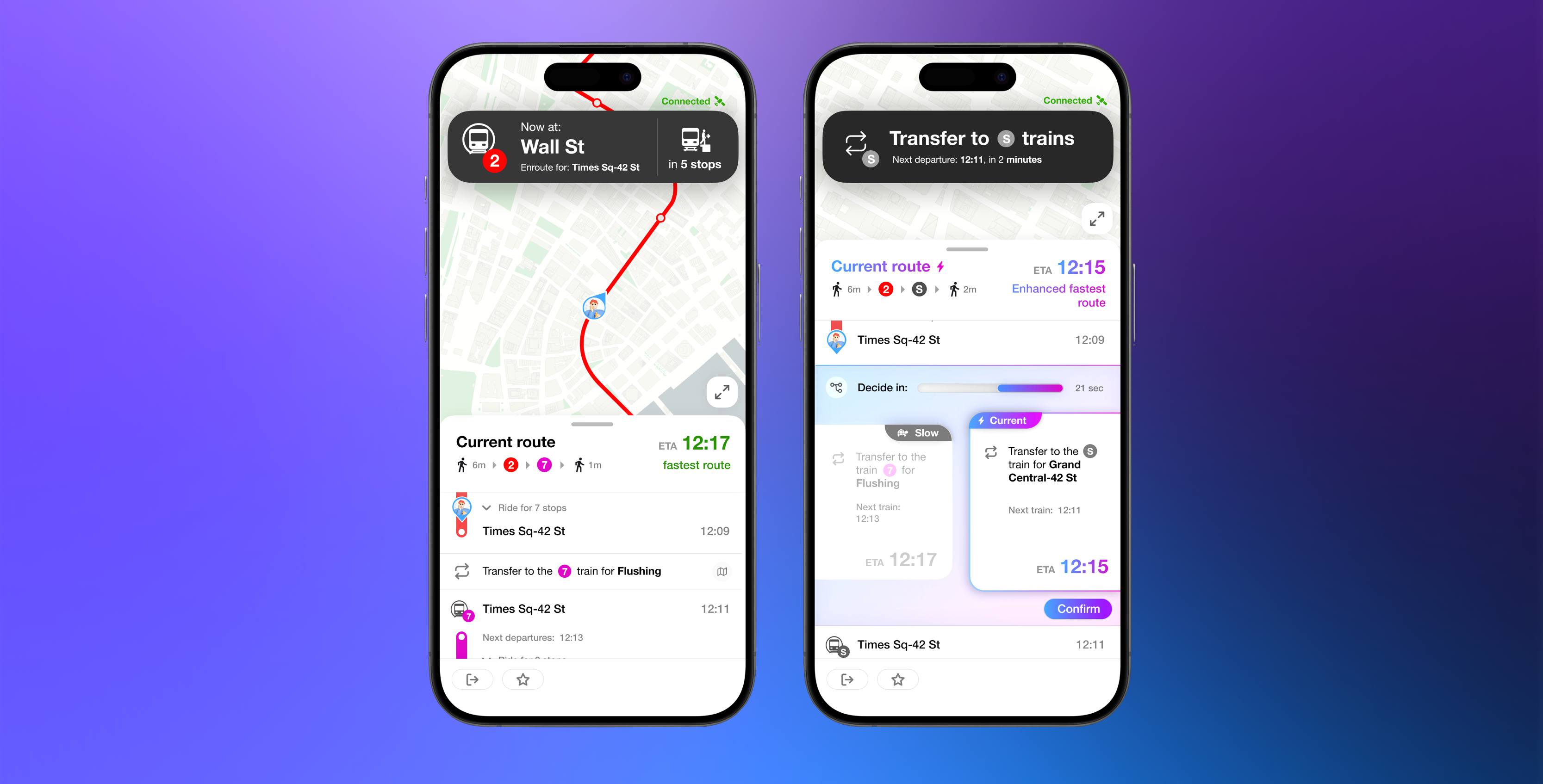
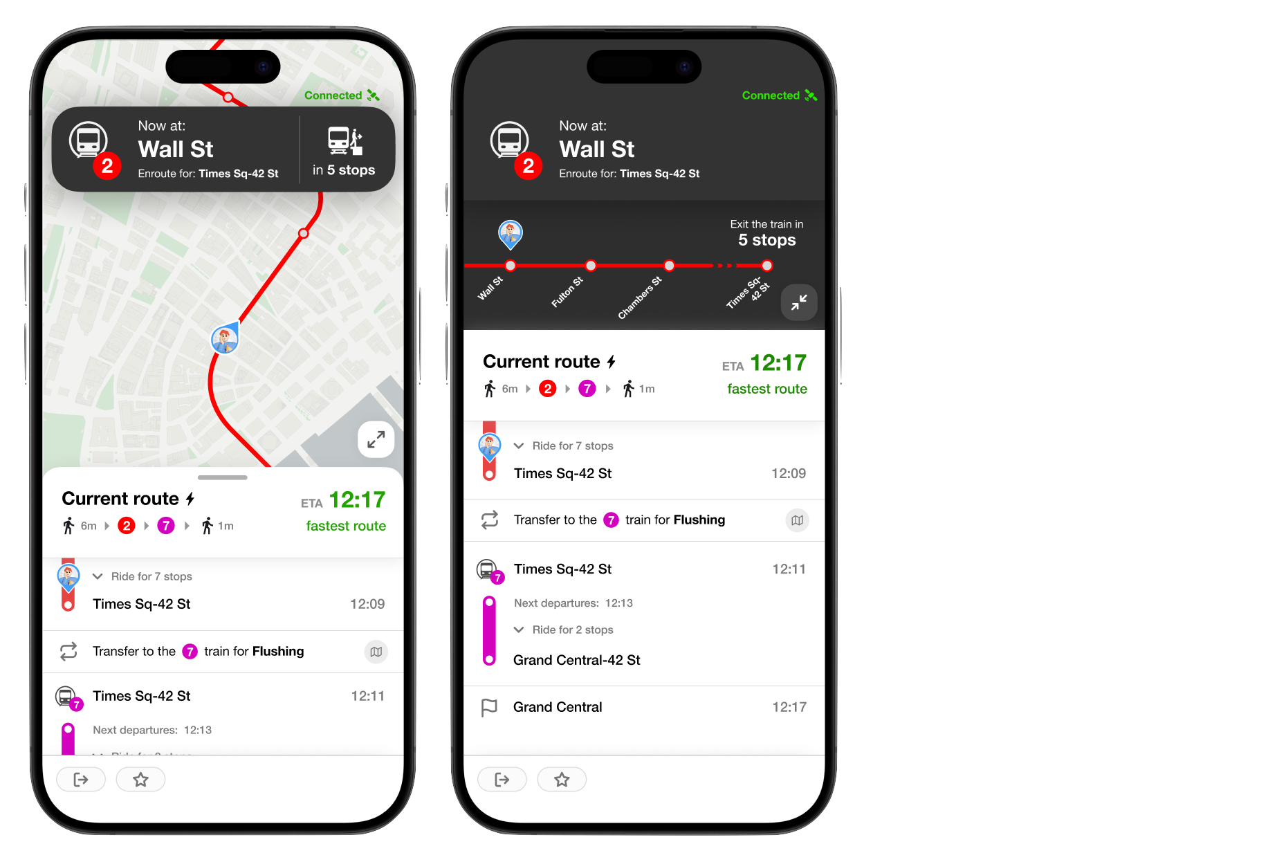
While the user is en route, a persistent banner at the top of the screen communicates the next immediate action, such as walking to a platform, boarding a train, transferring, or preparing to exit. The lower section presents the overall progress of the commute, helping the user understand both what to do next and how much of the journey remains. Selecting the expand icon transforms the standard map into a full-screen route view, where the complete sequence of stops, transfers, and upcoming actions can be reviewed in greater detail.
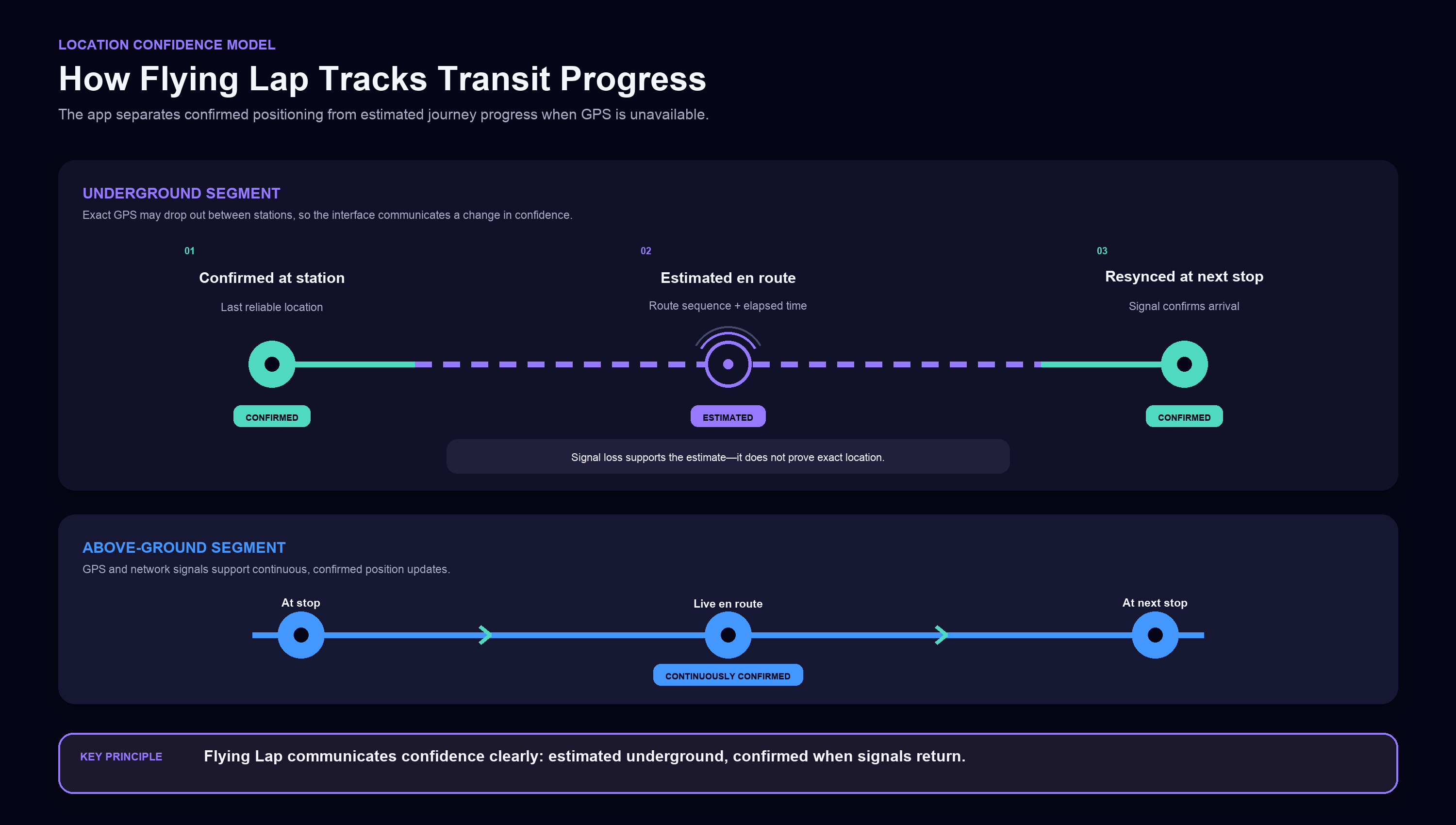
How Does the App Track Users Underground?
Because GPS and mobile connectivity may become unreliable underground, Flying Lap does not claim to know the user’s precise position at every moment. Instead, it estimates journey progress using the last confirmed location, the selected route and station sequence, elapsed travel time, available transit data, and any device signals that remain accessible. The loss or return of connectivity can support this estimate, but it is not treated as definitive proof that the user has departed or reached a station. Once a reliable signal becomes available again, the app confirms the user’s location and updates the journey accordingly, while clearly distinguishing estimated progress from confirmed positioning.
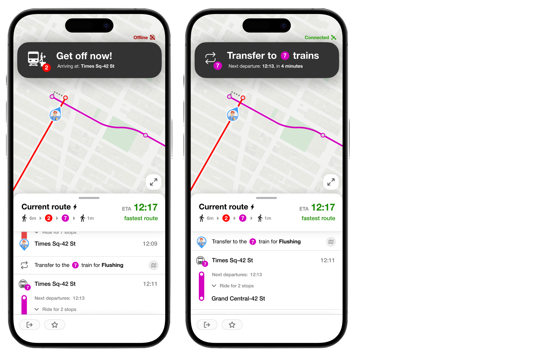
3. Transfer Guidance
When the user reaches a transfer point, the top banner clearly communicates that it is time to exit the current train and continue to the connecting service. The interface presents the transfer as the next immediate action and provides the information needed to locate the correct platform or line, reducing uncertainty during one of the most stressful parts of a public transit journey.
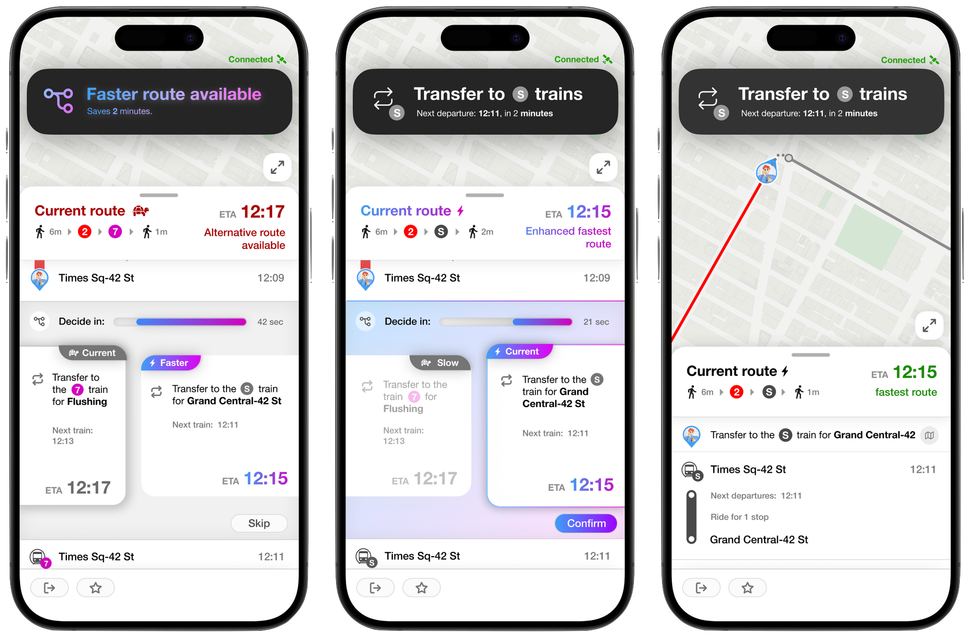
4. Faster Route Recommendation
If changing conditions create a faster alternative, Flying Lap presents the option through a clear call-to-action without automatically disrupting the current journey. The prompt explains that a quicker route is available and allows the user to either switch routes or continue with the original plan, giving them timely guidance while keeping the final decision under their control.
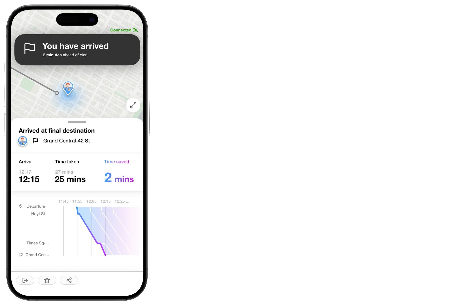
5. Arrival Summary
Once the user reaches the destination, Flying Lap displays an arrival summary that confirms the journey is complete and presents the most important trip information in one place. This final screen provides a clear sense of closure while helping the user understand how the route, transfers, and real-time adjustments contributed to the completed commute.
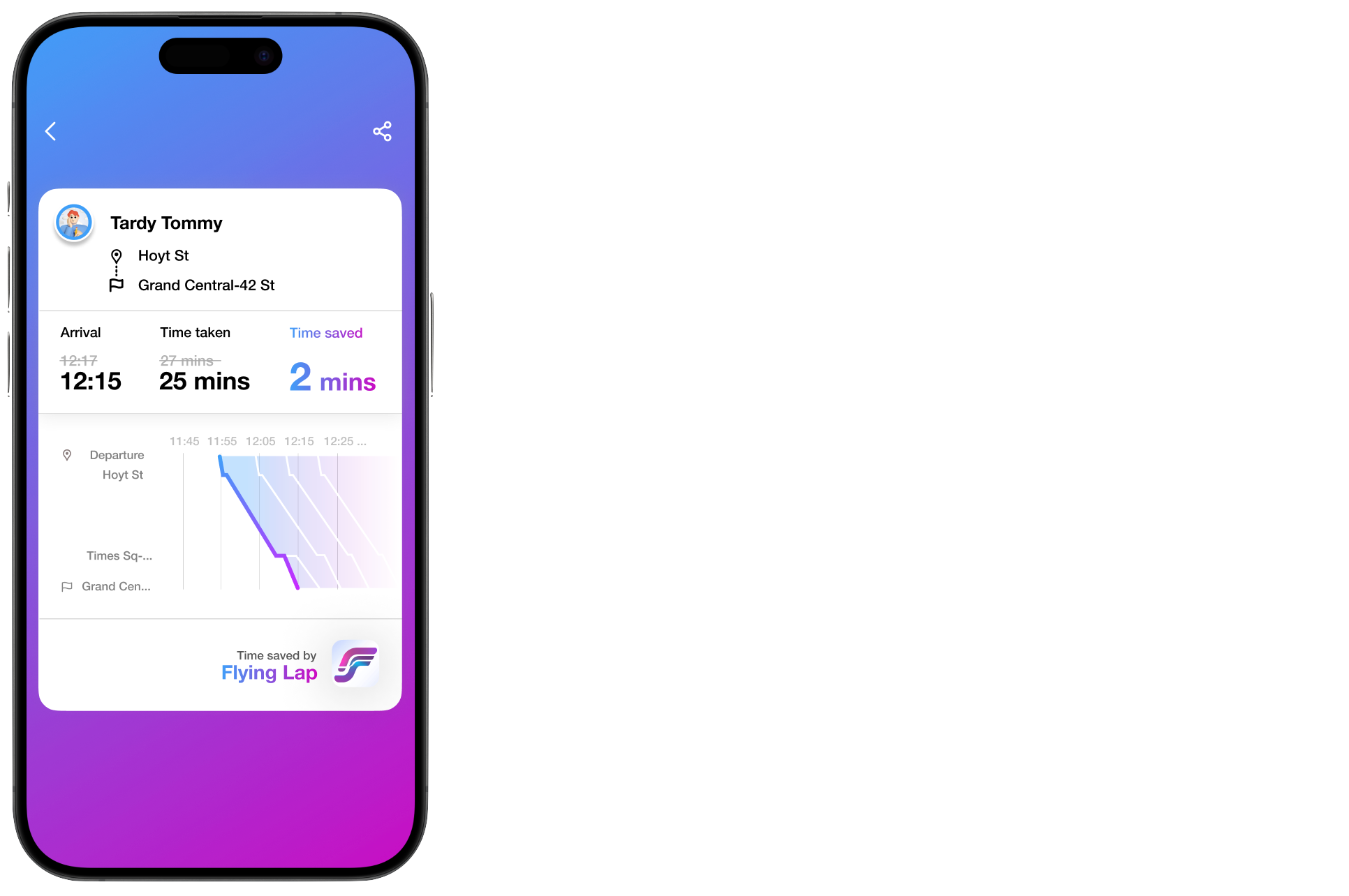
6. Share the Journey
From the arrival summary, the user can select the share button to generate a visual record of the completed commute. The shareable image presents the journey’s key details in a clear and engaging format, allowing users to save the experience for themselves or share it with friends. This feature transforms an everyday transit journey into a personal achievement while extending the experience beyond the app.
05 — CONCLUSION
THE RESULT
Looking Back
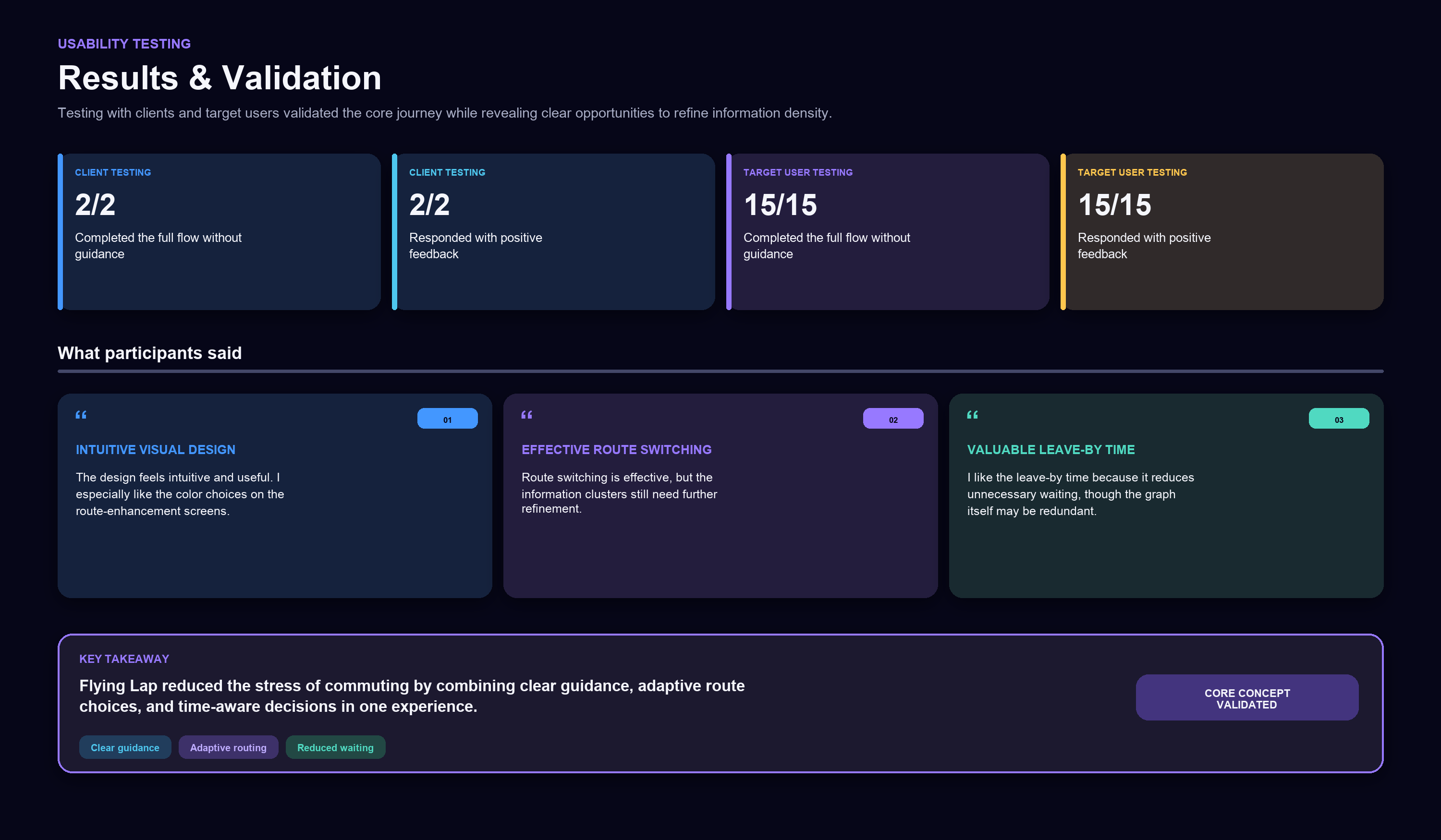
The Flying Lap project demonstrates how a transit experience can become more manageable when guidance is timely, clear, and responsive to changing conditions. By combining features such as get-off alerts, step-by-step instructions, leave-by times, and real-time route recommendations, the design addresses common commuter challenges without adding unnecessary complexity. Feedback from clients and target users was largely positive, validating the product’s practicality and its potential to reduce the uncertainty and stress associated with navigating New York City’s public transit system. The project also revealed opportunities to simplify information clusters and remove redundant visualizations, providing a clear direction for future refinement.